The tour, designed by the Williamstown Historical Commission and hosted on the Williamstown Historical Museum’s website, includes 75 buildings or sites of buildings in Williamstown of historic interest. It also includes two pre-colonial trails used by Native Americans.
It is designed as a “windshield tour.” You can begin anywhere, but the designers of the tour believe that beginning at #1, on the west end of Main St., is probably the most efficient way to see all 75 sites. Some of the buildings on the Williams College campus can be entered, but note that most of the houses are private residences. Please do not enter those properties.
Visitors taking the tour who wish to see only a subset of the 75 – for example, historic churches — can click on one of the following “tags,” and will be directed to churches.
Colonial Williamstown; Williams College campus; Churches; Schools; Cemeteries; Hemlock Brook Neighborhood; National Register.
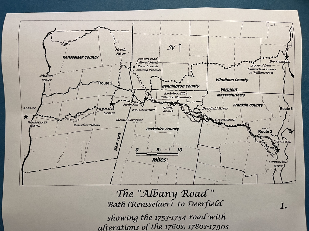
1. Albany Turnpike. Laid out by early settlers beginning in 1773, it went along West Main Street, turned left just past 1385 Main St., over Bee Hill (via present-day Bee Hill Road and the abandoned “Bee Hill Extension”), up present-day Berlin Road to Berlin Pass, where there was a tollgate, and from there over the Taconic Range and down into New York State.
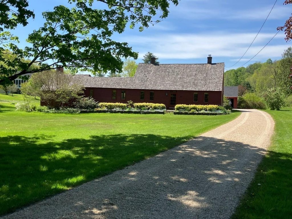
2. 1385 Main Street. Red saltbox. 1767. A “saltbox” (two stories in the front, one story in the rear, with a gable roof), a traditional New England style, built about 1765 on what was then the corner of Main Street and the original line of the main westward highway (Bee Hill Road). It originally had four rooms, two chimneys, a central hallway, and a substantial second floor for sleeping. The house served at various times as a tavern and as a school. It was enlarged in 1830 and 1971. Today, it is a private residence.
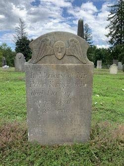
3. 1205 Main Street. Westlawn Cemetery. 1766. Laid out on land purchased from John Newbre, for 75 years it remained the only cemetery in the northern section of town. Newbre’s daughter Anne, who died in 1762, was reburied on the property. One of the oldest stones is Peter Kriger’s from 1772 (pictured here) – he and his brothers ran one of the earliest mills in town at the confluence of Green River and Hopper Brook. Several other early settlers, including Benjamin Simonds (1726-1807) and Thomson Skinner (1752-1809), both leading town citizens during and just after the Revolutionary Era, are buried here. The large Danforth obelisk/monument was erected in the late 19th century on land donated by the family of Keyes Danforth. Also buried in Westlawn, in the family mausoleum, are Robert C. Sprague (1900-91), the founder of Sprague Electric Company, along with his brother, Julian, and his parents.
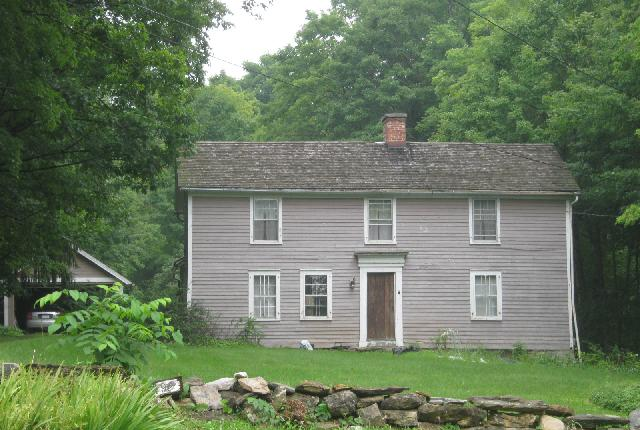
4. 1192 Main Street. Dr. Meack House. Circa 1768. Built or bought by Dr. Jacob Meack about 1768, the front part of this house is built around an original “regulation” house. (A “regulation” of the colonial legislature required that to prove their claim the first proprietors were required to build a house at least 18’ x 15’, with walls at least 7’ high. A replica of a regulation house, constructed in 1953, sits now in Field Park.) It was for Dr. Meack, the first physician in town, that early settlers named this part of Hemlock Brook “Doctor’s Brook.” The house is a private residence.
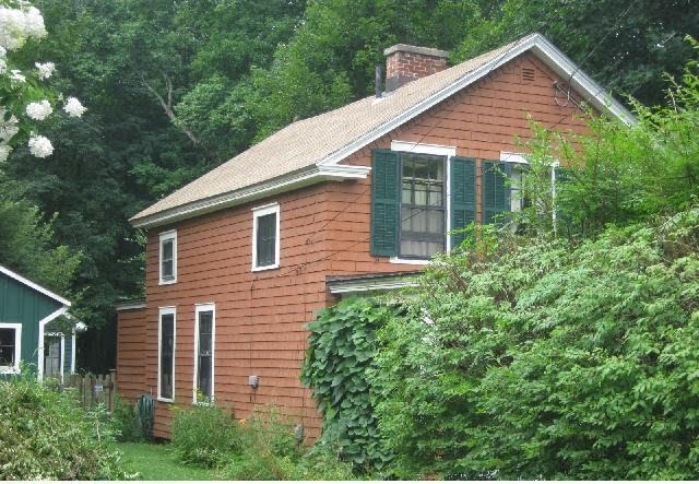
5. 1183 Main Street. Site of Seth Hudson’s house. Circa 1752. On this site stood the house of one of the first settlers, Seth Hudson. A “regulation house,” it was located on the banks of the brook and in what was then the center of the settlement. Here the Proprietors chose officers and committees, imposed taxes upon themselves, planned the division of meadows and uplands, and made provision for highways. The house was later moved down Hemlock Brook to what is now Bulkley St.. The present house at 1183 Main, a private residence, was built in the 1830s.
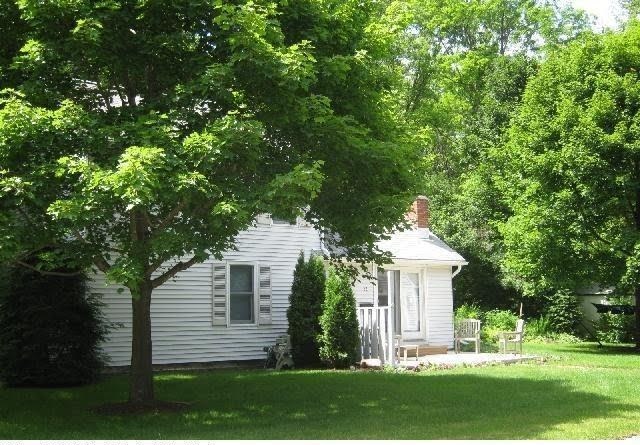
6. 32 Danforth Street. Historic Beldenville. Circa 1900. The little neighborhood that used to be called Beldenville consisted of Belden St. and the three small side streets branching off of it, Danforth St; Bryant St., and Porter St; Beldenville was home for decades beginning about 1900 to the extended Porter family, African-Americans who moved there from White Oaks. It was surveyed and laid out by Alexander Walker in 1887 in mostly 50′ x 100′ lots for its owner, Charles D. Belden. 32 Danforth St. is a private residence. A number of house lots were sold in the 1890s, including three to George Porter, a plumber. He and his children continued to live on Belden St. into the 1930s. When Porters and Todds intermarried, it was also home to members of the extended African-American Todd family. Over time the Porters and Todds died or moved away, the last of them in 1973.
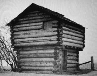
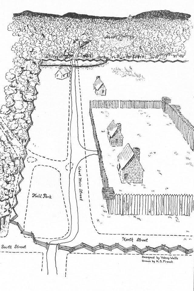
7. 1090 Main Street. Site of the West Hoosuck Blockhouse. 1756. Built as protection from French soldiers and their native allies during the French and Indian War, it was set back from both Main St. and North St. The men in the 40’ x 40’ blockhouse engaged in a skirmish in July 1756 when three farmer-soldiers left the Blockhouse to look for their cows, which had wandered down Hemlock Brook toward the Hoosic River. A group of some forty to fifty Abenaki, spotted in the area in recent weeks, surprised the men and quickly killed them and their cows. A few Indians crept up to the Blockhouse and reportedly fired about two hundred rounds before withdrawing.
The Blockhouse also served briefly as the meeting place for the Proprietors until the construction of a schoolhouse on the northeast corner of North and Main streets in 1763, when the blockhouse was dismantled and its lumber re-purposed. In the late 19th century the Kappa Alpha fraternity house stood on the corner of North St. and Main St., and in 1892 Harley Proctor built on the site a grand summer house, which later became the new home of KA. In 1968 that building burned, and in 1974 was replaced by a newly-constructed Williams Inn (formerly on the Williams College campus, in what is now Dodd House). The Inn was demolished in 2019 when the Williams Inn moved to the foot of Spring St. Construction of a new Williams College Museum of Art on the site began in 2025 and is scheduled to be completed in 2027.
Hoosic or Hoosuck? West Hoosuck was the name of the town before it became Williamstown in 1765. The river is the Hoosic. The mountains east of North Adams are part of the Hoosac Range. The town near Troy is called Hoosick Falls.
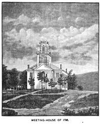
8. Field Park. Site of the second Meetinghouse. 1798. “Meetinghouse” was the old name for a Congregational church in New England. Erected on a hilltop at the western end of the original town green on what was then known as The Square, the second Meetinghouse served as the center of town governance and for Williams College commencement ceremonies. It burned to the ground in 1866, destroying many early town records.
It replaced an earlier crude building, 30’ x 40’, with one door, few windows and no chimney, which was moved further to the west in 1798 to make way for the second meetinghouse, and was used for town meetings and as a school until it burned in 1828. The second meetinghouse was larger and more dignified.
After the 1866 fire the church moved to its present location on Main St. In 1878, with a donation by Cyrus W. Field, the Village Improvement Society created Field Park.
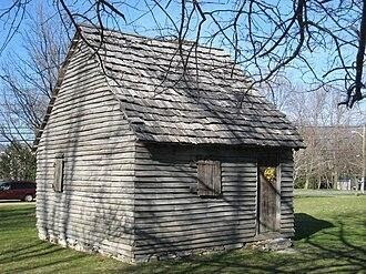
9. Field Park. The 1753 House. 1953. A replica of a “regulation house,” constructed in Field Park as part of the town’s celebration of the 200th anniversary of its founding, using tools from the 18th century.
Tag: Hemlock Brook Neighborhood
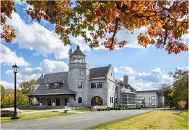
10. 1065 Main Street. Williams College Bruton Center for Development Economics. 1886.The front part of the building was designed by Stanford White of McKim, Mead & White. Long serving as the home of the Delta Psi fraternity, it was expanded after fires in 1905 and 1927. In 1968, with the elimination of fraternities at Williams, it became the Center for Development Economics offering intensive, one-year M. A. degrees to young economists from government and financial institutions in developing countries.
Tag: Hemlock Brook Neighborhood; Williams College campus
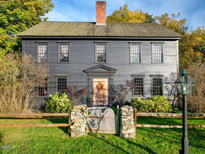
11. 196 South Street. Horsford House. Circa 1778. Long thought to have been built by William Horsford in 1763 or 1764 on the site of what is now the Williams College president’s house on Main St., this house was built, so recent dendrochronological (tree-ring) evidence suggests, with trees cut in 1775-76. It was relocated in 1802 to its present site by eight span of oxen to make way for a new house built by Thomas Sloan, which later became the Williams president’s official residence. The Horsford house was extensively restored in 1952. It is now a private residence.
Tag: Colonial Williamstown
12. “County Road.” Laid out by early settlers beginning in the 1760s, following old Native American trails, linking present-day Pittsfield with present-day Pownal, roughly following the path of today’s Route 7 north from the New Ashford town line to Five Corners, then over Stone Hill via the old Stone Hill Road (part of which was later abandoned), up South Street, and via North Street across the Hoosic River, and from there along the north bank of the river into present-day Pownal.
Tag: Colonial Williamstown
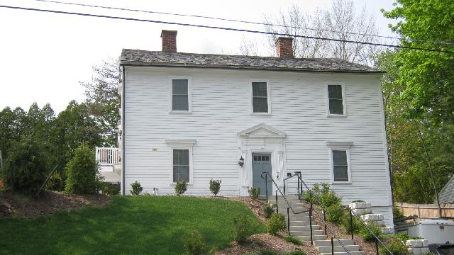
13. 65 North Street (facing Lee Terrace). Benjamin Mather House. Circa 1850. Mather (1810-88) and his son, Charles, were the leading Williamstown merchants in the mid-1800s. Benjamin’s house was located on the site of the present ‘62 Center for Theatre and Dance, and his general store was located just to the west. Mather House was for many years home to the Williams College admissions office. It was moved to Stetson Court in 2002 to make way for the ’62 Center and was moved again in 2014 to North St., where it houses part of Guntlow & Associates.
Tag: Hemlock Brook Neighborhood
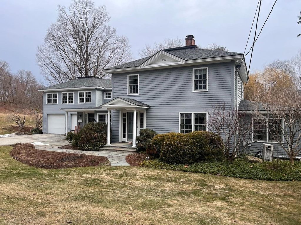
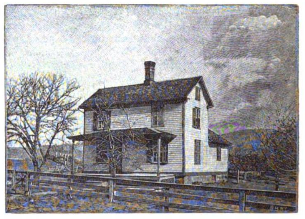
14. 56 Bulkley St. Seth Hudson House. 1752. Now much enlarged, the house was built around the one-room 1752 Seth Hudson “regulation house” that once stood on Main St. (Some of the original interior timbers are still exposed.) In the early 19th century it was moved down Hemlock Brook to its present location, where it served as a wheelwright’s shop. Over time the one-story house became two stories, and substantial additions were made. It is now a private residence.
Tag: Colonial Williamstown; Hemlock Brook Neighborhood
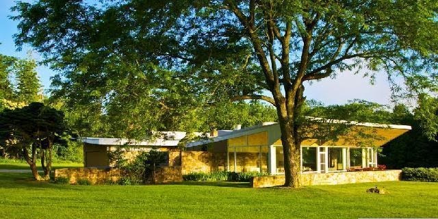
15. 236 Bulkley Street. Robinson House. 1948. Built for Preston Robinson (a Sprague Electric Company executive) and his wife, Helen, the house was designed by modernist architect Marcel Breuer. One of Breuer’s best houses, it demonstrates his binuclear plan, which splits public and private space, and emphasizes the split with a butterfly roof. The house remains a private residence and cannot be seen from Bulkley Street. Those taking the tour should not try to enter the property.
Breuer had been a design critic in architecture at Harvard University’s Graduate School of Design. Breuer and Walter Gropius, both expatriates who had left Europe as Germany descended into fascism, established themselves at Harvard and trained a generation of architects in the tenets of austere International Style modernism. Breuer left Harvard and opened his architectural practice in New York City in 1946.
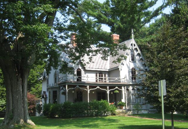
16. 95 Park Street. Gothic Revival cottage. 1854. On the corner of Whitman St., started in 1854 by Williams College President Paul Chadbourne and finished a few years later by Professor John Bascom. The architect is unknown, but the house is clearly derived from the published work of Andrew Jackson Downing. The exuberant Gothic ornamentation was restored in 1990. It is now a private residence.
Tag: Williams College campus
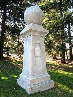
17. Mission Park Drive. Haystack Monument. 1867. In Mission Park, created by Williams College in 1856, stands the Haystack Monument, commemorating the so-called 1806 “Haystack Prayer Meeting” when five Williams students, gathered for prayer, sheltered from a rainstorm in the lee of a haystack. The pledge they made that afternoon inspired the founding of the American Board of Commissioners for Foreign Missions.
The monument is sacred to a number of evangelical students on the Williams campus, to some Williams alumni, and to many evangelical Christians around the world, some of whom make pilgrimages to see it. For others, it is a symbol of the damage done by Protestant missionaries in imposing their religious beliefs on Asians and Africans who had been practicing native religions.
Tag: Williams College campus
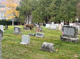
18. Stetson Road. Williams College Cemetery. 1856. Set aside from college land and enlarged in 1882, this cemetery was designated for Williams College trustees, faculty, and descendants of President Mark Hopkins, down to the present day. Monuments here also honor the first and third Williams presidents, Ebenezer Fitch (1755–1833) and Edward Dorr Griffin (1770–1837), who are buried elsewhere.
Tag: Williams College campus; Cemeteries
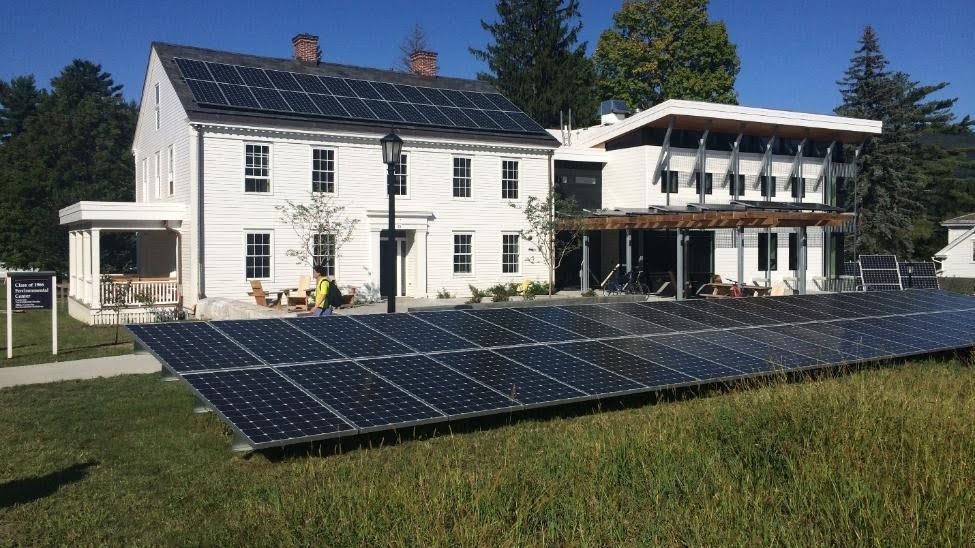
19. 41 Mission Park Drive. Kellogg House. 1794. Kellogg House has moved more times than any other college building. It was built in 1794 for Ebenezer Fitch, the first president of Williams, and was located on the present site of Hopkins Hall. It served as the house of Williams presidents until 1858, when President Mark Hopkins moved to the current house on Main St. An addition was completed in 1995. Moved to its present location in 2011, in 2017 it became one of the few 18th-century buildings in the country to be retrofitted to “Living Building” environmental standards. Because of its many additions, it displays architectural styles of several periods.
In 1872, the house was moved north to the present location of Stetson Hall, and became the residence of a series of Williams professors, including James Lawrence Kellogg. In 1919 the house was moved northward down the hill and turned ninety degrees, to make room for Stetson Hall. Kellogg House served as faculty housing until 1978, when the Center for Environmental Studies moved in. The building was moved again in 2008, to make way for the new Sawyer-Stetson Library, and yet again in 2011 in preparation for the addition of a new wing.
Tag: Williams College campus
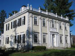
20. 936 Main Street. Sloan House. 1802. Designed by a Boston architect, this late Federal house was built in 1802 by General Samuel Sloan, a wealthy farmer who moved to the North Village from South Williamstown. The ornamentation on the façade came from Boston. It was a private residence until 1858, when it became the official residence of Williams College presidents. The large rear section of the house is an early-20th-century addition. It is a private residence.
Tag: Williams College campus
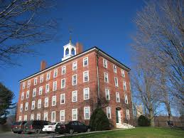
21. 931 Main Street. West College. 1790. Built as the Free School in Williamstown with money from the estate of Col. Ephraim Williams and $3,500 raised by lottery.The trustees of the Free School later petitioned the General Court of Massachusetts to allow its conversion to a college, and Williams College opened its doors in October 1793, under President Ebenezer Fitch. The building, known as West College, was remodeled in 1855 and 1905 and suffered a disastrous fire in 1951, but the brick exterior largely remained.
The interior was rebuilt with a frame of concrete and steel, and a new interior plan. Hopkins Gate, just east of West College, built in 1926 as the formal entrance to West College, was designed by landscape architect Fletcher Steele.
Tag: Williams College campus; Schools
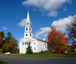
22. 906 Main Street. First Congregational Church. 1869. When the Second Meetinghouse burned in 1866, the church raised money over the next several years for a new building in a new location. The new Congregational Church (no longer called a “meetinghouse”) was constructed of brick in the German Romanesque Revival style. In 1914, a rebirth of classical taste and a gift from a church member inspired church authorities to encase the brick building in a white clapboard shell in neoclassical style, modeled in part on the newly-rebuilt 18th-century church in Old Lyme, Connecticut. There are two additions to the rear of the sanctuary, built in 1914 and 1960.
The college contributed land and $6,000 in 1869 toward the construction in order to have an auditorium for college functions. Baccalaureate and commencement exercises, as had been the case in the older meetinghouses, were held in this new Congregational Church until 1912, when Chapin Hall was completed.
Tag: Churches
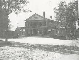
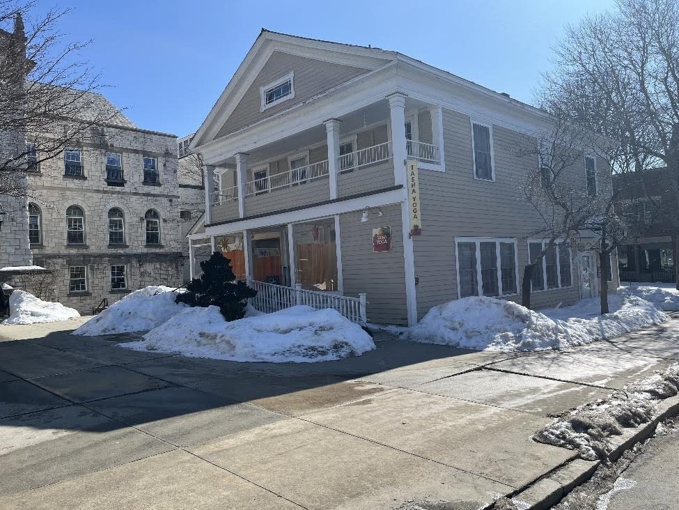
23. 9 Spring Street. Smith Block. 1842. Originally built on the lot where the Congregational Church now stands, the N.F. Smith bookstore was moved across the street in 1867 when the church bought the lot. It was moved again to its present location in 1886 to make way for the building of Lasell Gymnasium. For many years the front of the building was the site of Louis Rudnick’s laundry. It now houses a barber shop, a yoga studio, and offices for Williams College coaches.
Except for the years 1947-57, there was a bookstore in this building from 1842 until 1990, most recently Joe Dewey’s. The building has also served as a drug store, general store, post office (1848-1879), the town’s first telegraph office (1876), and first soda fountain (1885). Before baths were installed in the college dormitories, public baths for students were available in the basement of the building.
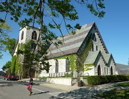
24. 836 Main Street. Goodrich Hall. 1859. Designed in Early English Gothic style by Gervase Wheeler and built of local dolomite with money raised by the Williams College Society of Alumni, whose early meetings were held in an upstairs room. The building served primarily as the college chapel until 1905 when Thompson Memorial Chapel was built. The old chapel was renamed Goodrich Hall, and the interior altered to serve as a reading room and classrooms. The building was extensively renovated in 1999 to serve as a student center and coffee shop.
Tag: Williams College campus; Churches
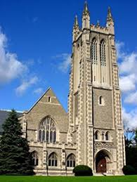
25. 860 Main Street. Thompson Memorial Chapel. 1905. Built in 1903-1905 with money donated by Mary Clark Thompson in memory of her husband, Frederick Ferris Thompson (Williams College Class of 1856), and modeled on a 15th-century Anglican church in Wells, England. The west transept window, dedicated to U. S. President James A. Garfield (also Class of 1856), was created by noted 19th-century stained-glass artist John LaFarge. The window was first installed in the 1859 stone chapel across the street and moved here in 1915.
Tag: Williams College campus; Churches
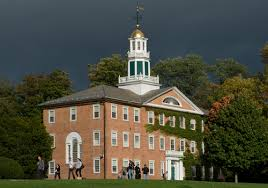
26. 844 Main Street. Griffin Hall. 1828. Patterned after a Charles Bulfinch building at Andover Theological Seminary, this building was designed and built as a chapel and classroom building by the college’s third president, Edward Dorr Griffin. The octagonal double cupola and gilded dome were elegant innovations in a small country town in 1828. The chapel was converted over time and now serves as a small lecture hall and as the site of Williams faculty meetings. A 1997 renovation introduced up-to-date AV equipment to the classrooms but removed ancient desks carved with initials of generations of students.
The chapel was located in the two-story room on the west side of the first floor. In 1904, Griffin Hall was moved 40’ north and east to bring it into line with the new Thompson Memorial Chapel, and the two front doors (one to the chapel and one to the classrooms) were replaced with a single central door.
Tag: Williams College campus
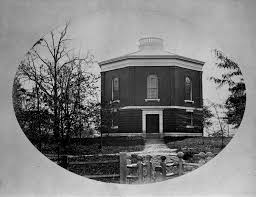
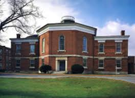
27. 15 Lawrence Hall Drive. Lawrence Hall. 1847. The original octagonal structure was designed by 19-year-old Thomas Tefft and built as the Williams College library, with the librarian seated at the center of a panopticon plan. The second-floor interior of the octagon with its eight exquisite ionic columns is one of the most beautiful spaces on the campus. Wings to the octagon were sensitively added in 1890. In 1922, when a new college library was built, Lawrence Hall became the college art museum.
Money to fund the 1847 building was donated by millionaire cotton manufacturer Amos Lawrence, a friend of President Mark Hopkins. Architectural historians Michael Lewis and E. J. Johnson call it “the single most consequential building of Williams College” and “the only one of national significance.” Further additions were made in 1926 and 1938. The final 1983 addition on the back (by Charles Moore) contains exhibition space, Art Department faculty offices, and classrooms. When the new college museum is completed, faculty offices will remain but exhibition spaces will be converted to “art maker” spaces.
Tag: Williams College campus
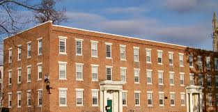
28. Lawrence Hall Drive. East College. 1797 and 1841. The original East College was built in 1797 with money granted to the college by the General Court from the sale of land in Maine. It burned to the ground in 1841. The college petitioned the court for $15,000 to rebuild, but was turned down and had to seek private contributions. Of the money needed, 54 percent came from residents of Williamstown. South College (now called Fayerweather Hall), to the south, was constructed the same year.
Tag: Williams College campus
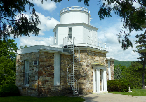
29. 829 Main Street. Hopkins Observatory. 1836-38. Designed and built by Williams College Professor Albert Hopkins and his students from stone they quarried on East Mountain, this is the oldest extant observatory in the United States. The paired columns on either side of the north door indicate that it was designed as the primary entrance. Today the building is still used as a planetarium, run by the college’s Physics and Astronomy Department. The main entrance is now on the south side. The building has been moved several times, in 1908 to the south end of the quadrangle behind it and in 1962 to the north end.
Suggesting the designers’ delight in mathematical forms, the building consists of a hexagonal central section flanked by rectangular wings, topped with smaller hexagon and a still smaller cylinder. The interior is a circle topped with a dome.
Tag: Williams College campus
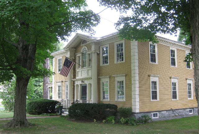
30. 796 Main Street. Day-Dewey House. 1798.This late-Federal-style house was built for Daniel Day, a prosperous farmer who moved into the center village. Ornamentation for the house came from Boston and brought Day to financial straits. He was forced to sell the house to Judge Daniel Dewey. The house was later used as a lodge for the Delta Upsilon fraternity. It is now a private residence.
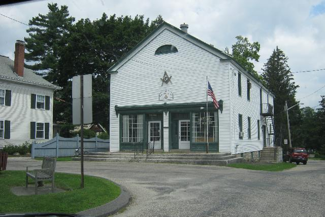
31. 772 Main Street. Stephen Horsford Store. Circa 1832. Built from bricks made at Horsford’s brickyard on South Street, this building used to stand right on Main St. and was later moved back. It was operated as a general store for many years by Horsford and later by Caleb Brown. The two-story balcony was removed; the brick walls were later clad in white vinyl siding. The building has served as a fraternity house, the town hall, and the public library. It now serves as a dentist’s office and a Masonic Lodge.
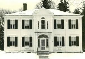
32. 762 Main Street. Botsford House. Circa 1815. First built for Daniel Noble, the house was long owned by the family of Joseph White, treasurer of Williams College and for fifteen years Secretary of the State Board of Education. In 1941 E. Herbert Botsford purchased and donated the house to the town for a public library in memory of his daughter, Elizabeth Sanford Botsford. The architectural details are clearly of local manufacture (from Asher Benjamin’s popular pattern books). Several original mantelpieces and moldings can still be seen. The house, which served as the town’s library until 1994, is now a private residence.
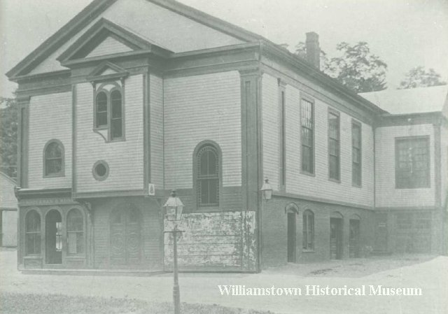
33. Water Street. Site of the Opera House. 1845. On the west side of Water St., just south of the former Methodist Church, is the site of the former Waterman and Moore Opera House. Built in 1845 as the Methodist Church, the wood-framed building was moved south in 1877 to become the Opera House when the new brick church was built on the corner. It was a center for traveling shows, college drama productions, dances, and town social activities, and also housed the town offices and fire department. In its last years from 1989 to 1992, it was a lumberyard. The structure was razed in 1992 to make way for the new studio art building for Williams College.
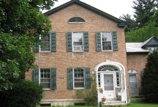
34. 732 Main Street. Smith House. 1817. This fine brick house was built for Dr. Samuel Smith and has remained in the Smith family to the present day. Dr. Smith’s office was in a small building to the west of the house. The current structure houses a full pipe organ, originally found in nearby Goodrich Hall. It is now a private residence.
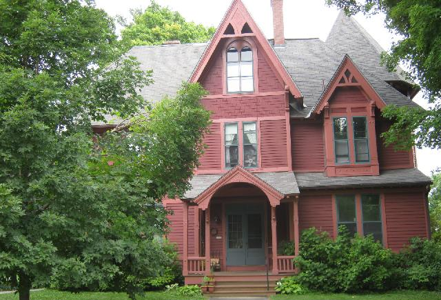
35. 718 Main Street. Asa Morton House. Circa 1880. Built by Joseph White, a treasurer of Williams College, this Queen Anne style house is based on plans published by Palliser and Palliser Architects of Bridgeport, Conn. It was purchased by Professor Asa Henry Morton and his wife, the painter Josephine Ames. Josephine had studied in Paris, and she finished the third floor as a studio salon, the scene of many Sunday afternoon social gatherings. It is now a private residence and architectural office.
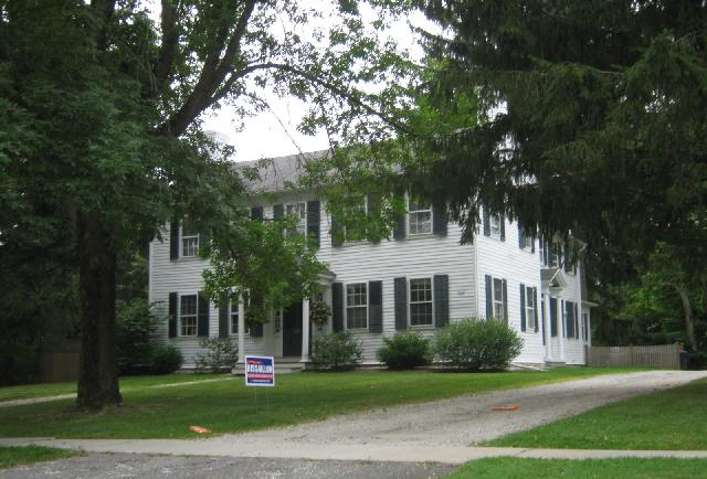
36. 711 Main Street. Bissell Sherman House. 1796. Sherman built this Federal-style house in 1796 after saving money as a farmer in the west end of the village. He opened a small store in the east room and a school on the second floor for neighborhood children. From humble beginnings, by investing and reinvesting, he became the richest man in town. The house is now a private residence.
Tag: Schools
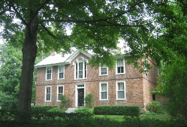
37. 674 Main Street. Judah Williams House. 1770s. During the Revolutionary War, Williams became very rich as a commissary to the Continental army, supplying beef cattle from his farms to Washington’s troops. Perhaps as early as 1771 he built this mansion. Made of bricks from a brickworks just opened nearby on the Green River, it was the first brick house in Williamstown and the finest house in town at the time. There were many changes to the exterior in the 19th century.The house is still a private residence.
Because Williams was paid in Continental money, inflation (which attended the war) ruined him, and he was forced to sell the house to David Noble. As the story goes, Williams piled the worthless “Continentals” in the front yard and lit a bonfire. Noble subsequently acquired nearly all the land north to the Hoosic River and west to what is now Southworth Street.
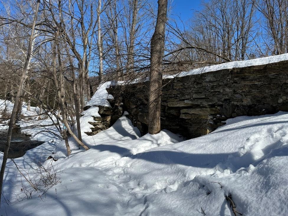
38. Main Street. Site of Walley Mill dam. 1826. About 200 yards upstream from the Walley Bridge on Rt. 2, accessible via the road through Eastlawn Cemetery on the banks of the Green River, are the remains of the dam that produced power for a cotton textile mill built in 1826 on the banks of the Green River about 100 yards north (downstream) of the bridge.
By means of an aqueduct, impounded water was carried downstream from the dam – and under a bridge — to power water wheels at the mill site. The mill reached its greatest prosperity during the proprietorship of Stephen Walley. In 1879, Williams College President Paul Chadbourne purchased the enterprise, along with local businessman and judge Keyes Danforth, who operated it until 1883 when it burned to the ground, throwing 70 people out of work. Abutments of the old dam are accessible via the road through Eastlawn Cemetery.
39. 605 Main Street. Eastlawn Cemetery.1842. Asahel Foote deeded this land to the town for the establishment of Eastlawn Cemetery. Over the years the cemetery was enlarged by additional gifts of land. Among those interred here are Nehemiah Smedley, an original proprietor of the town, along with many of his descendants, and Corporal Richard Welch (1828-94), awarded a Medal of Honor for his service in the Civil War. The Sherman Memorial Chapel was constructed in 1935 in memory of his mother (a member of the Bissell Sherman family) by Sherman H. Burbank. Eastlawn and the Sherman Chapel are on the National Register of Historic Places.
Tag: Cemeteries; National Register
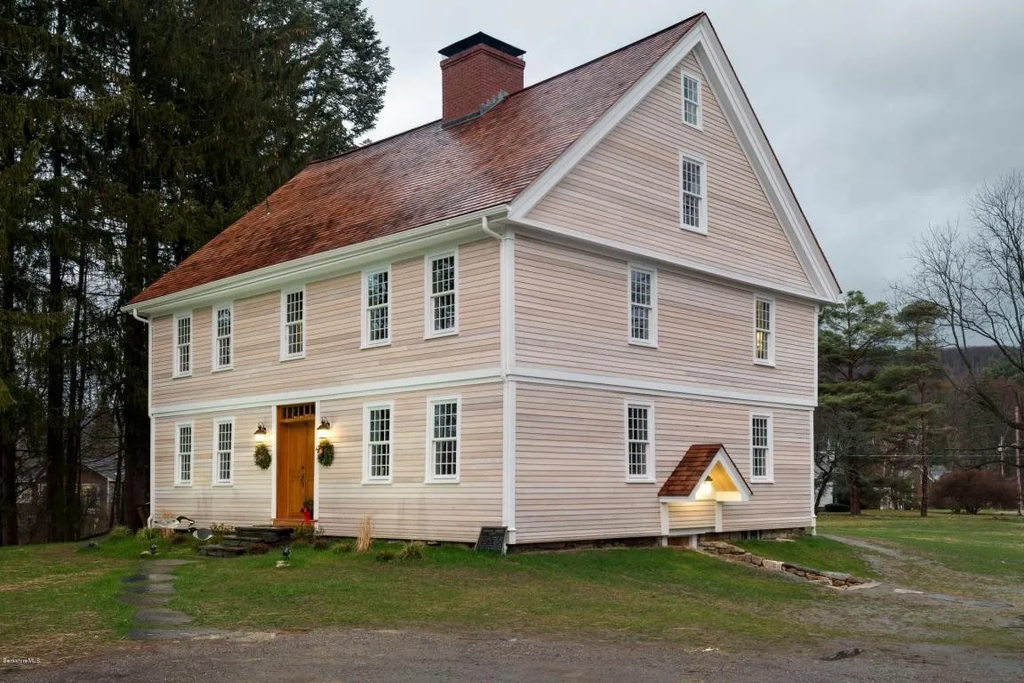
40. 530 Main Street. Smedley House. 1772. Built by Nehemiah Smedley, one of Williamstown’s original proprietors and a militia officer, this house also operated as a tavern. On May 6, 1775, Benedict Arnold stayed here while traveling to join Ethan Allen in the capture of Fort Ticonderoga. The basement’s large oven was used to bake bread for Captain Smedley and his military company after the Battle of Bennington in 1777.The house, now a private residence, was restored in 2016.
Tag: Colonial Williamstown
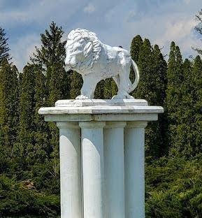
41. 60 Main Street. Gate to The Spruces. 1965. In 1954, 235 acres of former farmland between Route 2 and the Hoosic River were turned into a mobile home community called The Spruces by developer Albert Bachand who, over the next dozen years until he sold in 1967, built a pond, swimming pool, windmill, and fountains. In 1965 he bought the reinforced-concrete lion gates, which used to stand in front of the state capitol building in Albany.
As many as 350 people lived at The Spruces. But because it was located in a floodplain, it occasionally flooded when the river overflowed the berm along its banks. In 2011 Tropical Storm Irene inundated the site and brought an end to the community, displacing 300 residents. In 2013, with federal money, the town bought the property and gradually converted it to a 114-acre park.
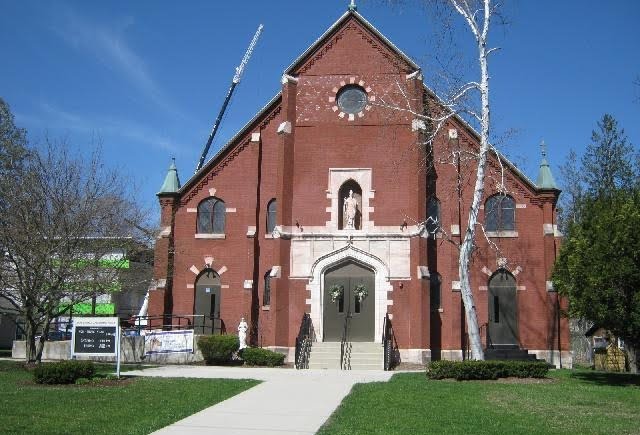
42. 63 Southworth Street. Sts. Patrick and St. Raphael Catholic Church. 1897. Built as the new home of St. Patrick’s Church, which had formerly occupied its own building on the corner of Main St. and Park St. Primarily (but not only) serving Irish immigrants and their descendants, it was known for many years as “the Irish church.” In 1997 St. Patrick’s merged with St. Raphael’s – “the French church” – and since 2009 the building on Southworth St. has served what were once two distinct parishes.
Tag: Churches
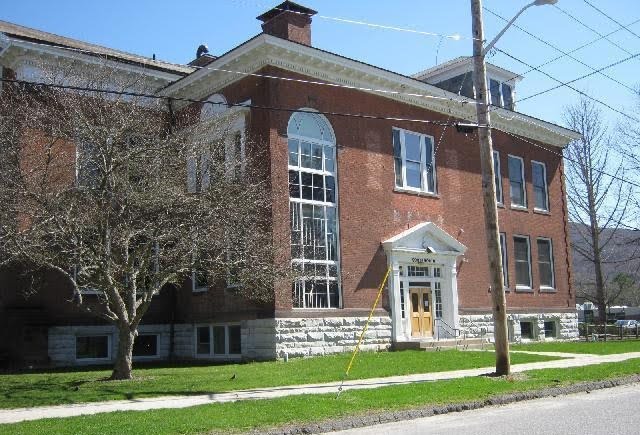
43. 96 School Street (facing Southworth Street). Williamstown High School. 1898. Replacing the former high school on Spring St., the building served the town’s high school students until 1961, when Mt. Greylock High School was built. Then, as the renamed Southworth School, it served elementary students until 2001. The Southworth School was bought from the town in 2003 by Williams College and converted in 2004 to the 14-unit Southworth Apartments for faculty and staff.
It was one of three public schools on School St. Because of its historical importance, the building was preserved when the Grant School and the Mitchell School, serving elementary school kids, were torn down in 2002 when the present Williamstown Elementary School was built.
Tag: Schools
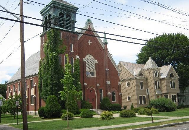
44. 201 Cole Avenue. Former St. Raphael Roman Catholic Church. 1889. Built by French-Canadian families in the neighborhood, many of whose members worked at the “station mill.” In 1989 the parishes of St. Raphael’s (the “French church”) and St. Patrick’s (the “Irish church”) were “yoked” and in 1997 united into a single parish. The last mass celebrated at St. Raphael’s was in 2007. In 2009 the building was sold to a developer, Church Corner LLC, which converted it and the rectory next door to eight units of affordable housing. The church steeple had to be removed. It is now a private residence.
The first priests were French-speaking Canadians who had previously held positions in North Adams or Pittsfield. Homilies were delivered in French. A primary school in the church taught English to French-speaking children.
Tag: Churches; Schools
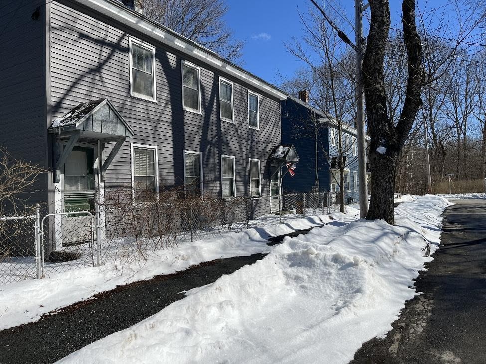
45. 60 Arnold Street. Mill Village. Circa 1900. In 1865 the Williamstown Manufacturing Co. built the “station mill” at the foot of Cole Avenue, utilizing water power from the Hoosic River, and over the next several decades built housing for the millworkers. One of the least altered mill villages in Massachusetts, Mill Village (Cole Avenue, Mill and Arnold Streets) was listed on the National Register of Historic Places in 1983.The houses are still occupied as private residences.
Williams College President Paul Chadbourne played a key role in the construction of both the textile mill and the village, which housed French-Canadian workers who immigrated from Quebec. After the textile mill closed in the 1930s, the houses in Mill Village were sold off, many of them to those who had worked there.
Tag: National Register
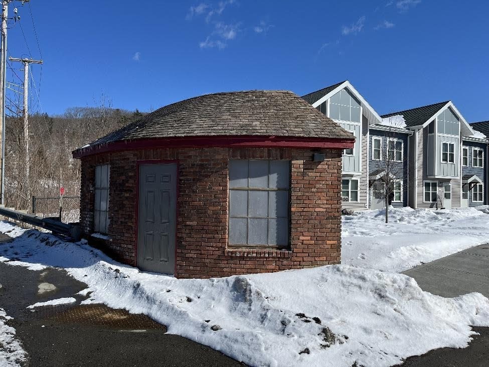
46. 330 Cole Avenue. Station Mill Gatehouse. Circa 1900. Formerly the site of the 19th-century “station mill,” and operated as a mill/factory until the late 1980s. Abandoned in 1989 by its last owners and allowed to fall into ruins, it was acquired by the town in 2007 and largely demolished. Rental apartments, constructed on the site, opened in 2021. A section of the mill built in 1944 and known as “The Cube” was incorporated into the tall building on the site. All that survives intact from the old mill – the largest in Williamstown – is the brick gatehouse at the entrance to the site.
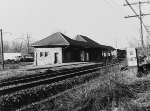
47. 370 Cole Avenue. Williamstown Railroad Station. 1898. The only stone masonry station on the Boston & Maine line, and distinguished by its Richardsonian Romanesque style, the Williamstown station replaced a wooden structure lost to fire. The adjacent rail yard to the northwest was one of the busiest on the line, with freight trains assembled here for journeys through the Hoosac Tunnel toward Greenfield and Boston. Both the station, now owned by Connor Brothers, and the railyard are on the National Register of Historic Places.
More:
For many years, until it closed in 1959, the building was the first impression of Williamstown for thousands of summer visitors and Williams College students arriving by train.
Tag: National Register
48. “Mohawk Trail.” Laid out by early settlers beginning in the 1740s, following the route of an old trail used by Mohawks and other tribes, including Mohicans, when they traveled up the Hoosic River from the Hudson River, originally along the river’s north shore, and over the Hoosac Range on their way to salmon-fishing grounds near present-day Shelburne Falls, homeland of the Pocomtucks, and to intertribal war when the Mohawks destroyed a Pocumtuck village in 1664. Not popularly known as the “Mohawk Trail” until the early 20th century, when in 1914 present-day Route 2 (to the south of the river) was improved, opened to automobiles, and promoted as a “scenic tourist route.”
Tag: Colonial Williamstown
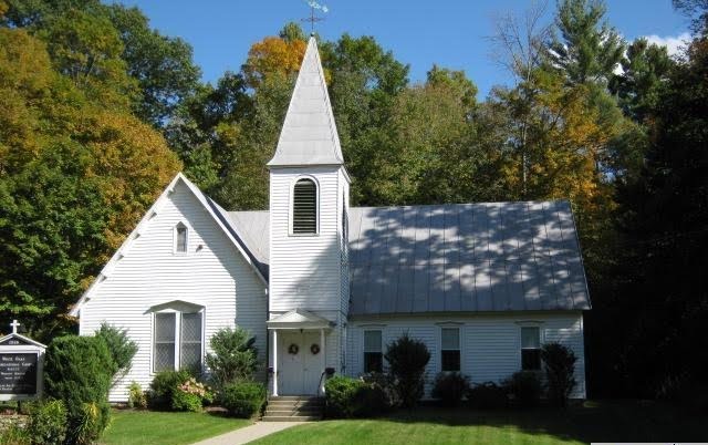
49. 480 White Oaks Rd. Church of Christ in the White Oaks. 1865. Built by Professor Albert Hopkins and volunteers (both white and Black) from what was once a largely Black neighborhood, the church is now known as the White Oaks Congregational Church, and continues to draw its parishioners from White Oaks.
Tag: Churches
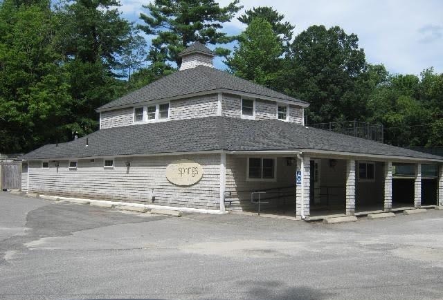
49. 158 Sand Springs Road. Sand Springs Pool. 1880. A natural thermal spring which rises through white sand and emerges at 72 degrees year round. Some evidence survives that centuries ago Native Americans knew of the springs, and considered them to be healing waters. In the 18th and early 19th centuries the springs were visited for medicinal purposes and for bathing by white settlers and by Williams College students. The Sand Springs Pool and Recreation Center (shown here), which served as a local swimming pool for decades but closed in 2011, re-opened in 2014.
In 1907 the owner of Sand Springs unearthed several shaped stones, buried four feet down, that appeared to be arrowheads, a spear point, and a tomahawk. When the Fred George family, a later owner of Sand Springs, undertook a construction project there in the early 1960s, they uncovered a number of arrowheads, but their collection has since been dispersed or lost.
Beginning in 1894 the water was bottled and sold, as it still is, by the Sand Springs Springwater Company.
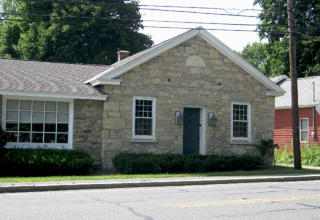
51. 681 Simonds Road. North School. 1838. A one-room schoolhouse, the North School was commonly known for decades as the “Stone School.” (The southern extension of the building dates from the late 20th century.) Possibly built by Willard Moody, a local stonemason. It was closed in 1869 when the students were reassigned to the newly-built Broad Brook School on White Oaks Road, and became a blacksmith shop, for a time reportedly for David Porter, an African-American from the extended Porter family who lived in White Oaks.
Porter was married to Annliza Case from Bennington, daughter of Peter Case, said to have been a “full-blooded Mohawk.” The building remained a blacksmith shop until 1915. No later than 1931 it became a garage (for auto and motorcycle repair). In 1991 it became a psychiatrist’s office, and in 2021 the headquarters of the local chapter of the American Legion.
Tag: Schools
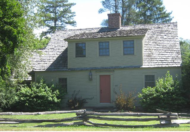
52. 668 Simonds Road. Regulation house. 1773. Built as a regulation house by Robert Hawkins, who served as one of the deputies from Williamstown at the 1774 County Congress in Stockbridge, called to protest one of the so-called “Intolerable Acts” imposed on the colony, it was bought in 1799 by 73-year-old Benjamin Simonds , who spent his last years there. It was later one of the many properties owned by Ephraim Seelye. Over the years the house was much expanded and remodeled. From 1925 until 1941 it served as the Cozy Inn Tea Room. Since then it has been a private residence.
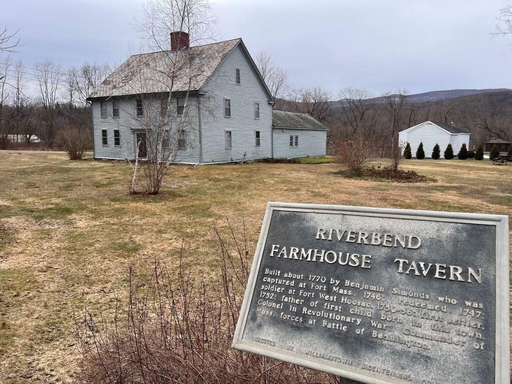
53. 643 Simonds Road. Simonds Farmhouse and Tavern. 1770. Colonel Benjamin Simonds built this house as both a home and tavern beside the north trail from the village. One of Williamstown’s earliest and wealthiest citizens, Simonds led his regiment at the Battle of Bennington in 1777. In the early 1770s he owned two enslaved African-Americans, freeing them both by 1783. Extensively restored, River Bend Farm (as it has been known since the mid-19th century) long served as a working farm and then in the late 20th-century as a bed-and-breakfast. The building is listed on the National Register of Historic Places. It is now a private residence.
Tag: Colonial Williamstown; National Register
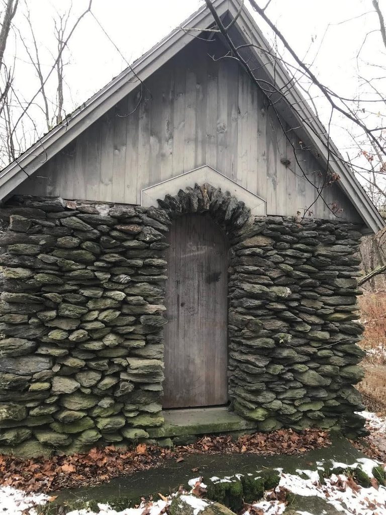
54. Off Latham Street. Fieldstone cabin. Date unknown. The photo shows a one-room fieldstone cabin – possibly an old ice house – on the banks of Phebe’s Brook, accessible by the walking path from the Williams Inn to Weston Field. Phebe’s Brook is the old name for Christmas Brook. Named after Phebe Holmes, who lived in a cabin on the short branch (or possibly the longer branch) of the brook in the mid-19th century. She was dark-skinned, maybe of mixed African-American and Native American heritage.
One branch of the brook rises on the east side of Stone Hill, flows past Buxton School, under Gale Road, through the Taconic Golf course, past the east side of the Williams Inn, into a culvert under Latham St., and (still culverted) through Williams College property, and drains into the Green River. The other branch rises in Denison Park, and flows in front of the Inn to join the other branch just upstream of the Latham St. culvert. Phebe was married to Johnson Holmes, said to have been a “well-authenticated Indian.” In the 1850s near the present-day college heating plant, the brook (then flowing above ground) was dammed to form what was later called Christmas Lake, site for community ice skating in the winter. (The lake was later drained.) About this time Phebe’s Brook became known as Christmas Brook. When the culvert under Latham St., was occasionally overwhelmed or blocked before it was replaced in 2016, the brook overflowed and flooded Latham St.
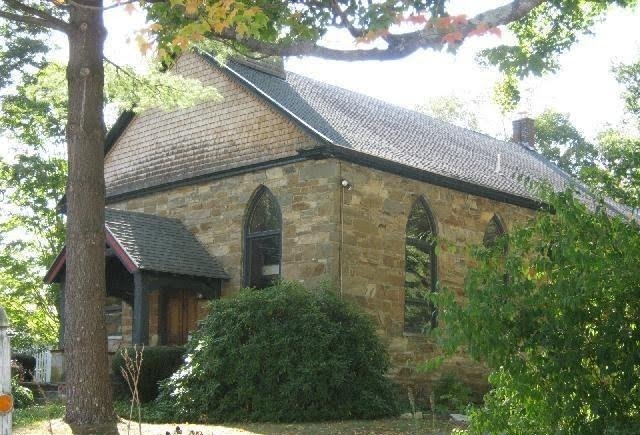
55. 1213 Green River Road. Stone Church. 1834. Built of local stone by a group of Baptists in the Sweet’s Corner neighborhood who had previously shared space in South Williamstown with a group of Congregationalists. In 1898 the church established a “mission church” in the center of Williamstown and by 1907 erected a building on the corner of Main St. and Thomas St. Both churches were served by the same pastor. Membership in the in-town church grew while membership at the Sweet’s Corner church declined, and services there stopped in 1936. For several decades the building stood empty, but was converted into a private residence in 1971.
Tag: Churches
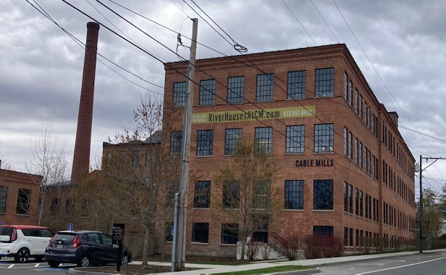
56. 160 Water Street. Carol Cable/General Cable Company. 1874. The factory complex was built beginning in 1874 for Loop, Hopkins & Co., which made cotton twine. Later owned by the Boston Finishing Company (to “finish” woven cloth) and the Boyd Manufacturing Company (to make fine textiles). Beginning in 1936 the factory produced wire, first for the Cornish Wire Company and later for Carol Cable and General Cable. After manufacturing ceased in 2000, the buildings were acquired in 2007 by a Boston-based developer who rehabbed them and opened them as the Cable Mills condominiums in 2016. The building is on the National Register of Historic Places.
Tag: National Register
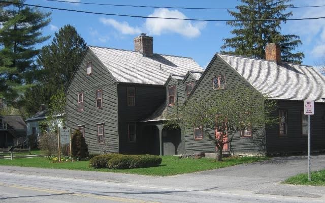
57. 95 Water Street. Regulation House. 1767. The lower northern part was built as a “regulation house,” and later expanded into a salt box. Over the next two hundred years, while it served as a private residence, additions and alterations were made to the structure. In 1976 those additions were removed, and the northern part was restored to its original appearance. The two-story southern part, added at that time, was designed to resemble a late-18th-century building. It is now a real estate office.
Tag: Colonial Williamstown
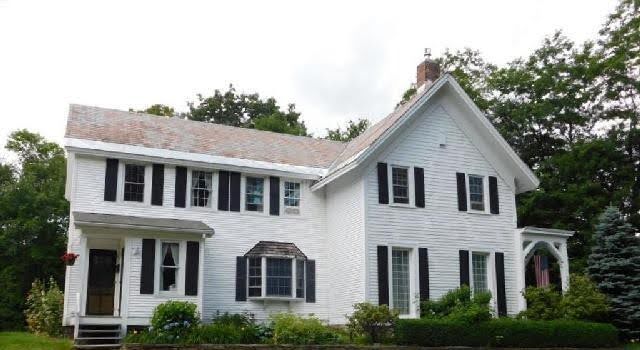
58. 78 Cold Spring Road. First Simonds Tavern. 1760. This house has a complicated history. It used to be located a little further north, on the site now occupied by the public library. Part of the original house dates to about 1760, when it was owned by Benjamin Simonds, who ran it as an inn and tavern on The Square before he built a new home north of the Hoosic River. In the 19th century it was long owned by the Sabin family, and under Dr. Henry Sabin, an abolitionist, it served as a site on the Underground Railroad. It was moved to its present location in 1888 when his son N. H. Sabin wanted to build a big new house. It is now a two-family private residence, much enlarged and modified over the last 250 years.
Tag: Colonial Williamstown
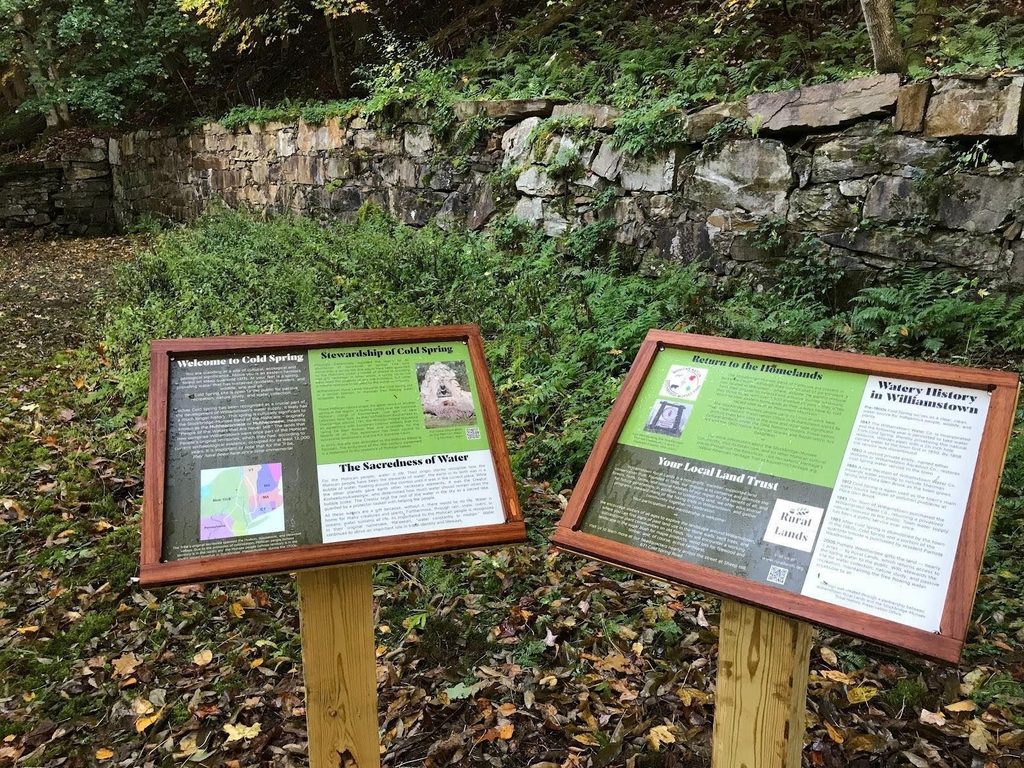
59. 671 Cold Spring Road. Cold Spring. 1847. A cold spring (as opposed to the “hot spring” at Sand Springs), flowing from the base of a steep hill, across from Coyote Flaco restaurant, The spring was developed by the Williamstown Water Company, incorporated in 1847, and taken over by the Williams Aqueduct Company which in 1862 built a masonry reservoir, its back wall still visible from the road, holding 1,764 gallons and covered with a substantial wooden roof. The town acquired the site in 1942 and continued to deliver water via a low-pressure line as late as 1962.
Cold Spring is one of numerous natural springs found throughout Williamstown. For many centuries before Williamstown was incorporated in 1765, Native American hunters (Mohawks or Mohicans), camped near the site of what is now River Bend Farm on Simonds Rd., might have traveled up Hemlock Brook in search of game and noticed the flow of water from the spring as it entered the brook. At least one projectile point, date unknown, was found along Sweet Brook (a nearby tributary of Hemlock Brook).
Because the elevation of the spring is only slightly higher than the town center it was designed to serve, water pressure was low. In 1962 the spring was abandoned as a water supply and in 1984 bought by conservationist Pam Weatherbee. The reservoir and its roof with supporting beams were demolished in 1985. Mrs. Weatherbee gave the land and spring to Williamstown Rural Lands in 2005. Spring water continues to flow in a trickle from the spring.
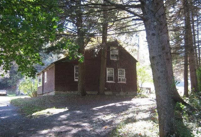
60. 734 Cold Spring Road. Bratcher House. Late 1760s. Built as a two-room house, later enlarged to four rooms with two bedrooms in an attic, and a saltbox roof. Long part of the “Noble Farm,” it has been owned since 1917 by the Bratcher Family. Henry Bratcher (1926-2011) spent thirty years as a mailman and six years as a town selectman. The house is a private residence.
Tag: Colonial Williamstown
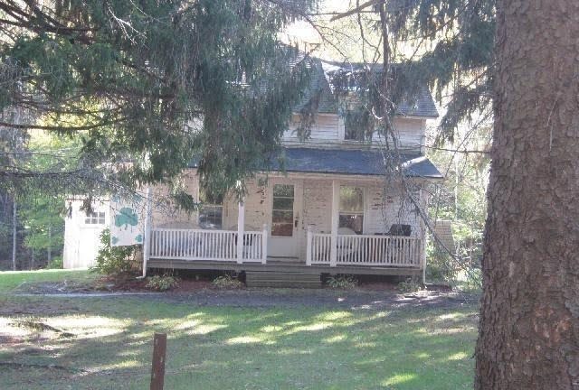
61. 988 Cold Spring Road. Bratcher Homestead. 1750s. This house was built a little earlier than the one at 734 Cold Spring Rd. The front porch is not original. Behind the house is an old barn on which you can still see a faded sign reading “Henry E. Bratcher, Contractor & Builder.” Bratcher was a master carpenter who in 1921 bought a contracting business. He died in the house in 1975. Private residence.
Tag: Colonial Williamstown
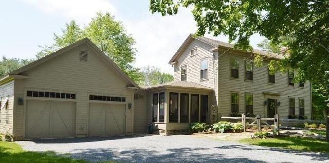
62. 644 Bee Hill Road. Hickox House. Circa 1799. The house was built by Stephen Hickox. He and his descendants farmed there for generations. It also served as an inn for stagecoach passengers on what was formerly the “Williamstown Turnpike” (which extended up Bee Hill Road, along the discontinued section, and over Berlin Pass). The screened porch and garage were added much later.
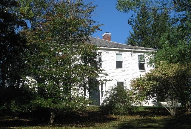
63. 2143 Cold Spring Road. Ambrose Hall House. 1806. Built by Ambrose Hall, lawyer, banker, and great-grandfather of Sir Winston Churchill. It subsequently became one of the outbuildings of the Mills Institute (a boys’ school) next door. Later, when the school building became the Idlewild Hotel, the house became part of the hotel. Obscured from the road except in the winter, it is now a private residence.
Tag: Schools
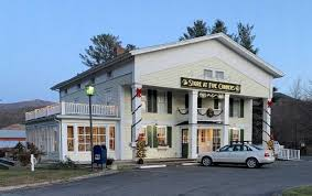
64. 4 New Ashford Road. The Store at Five Corners. 1770. Built as a tavern by Samuel Sloan on land purchased from Isaac Stratton. It was later home of the first South Williamstown post office (1827) and served as a general store. Under ownership of John Jordan (1833-65), the second floor and Greek Revival portico were added. In the late 19th century the building served as a hotel. For most of the 20th century (1905-78) it was owned and operated by the Steele family, and known as “Steele’s Store.” It was purchased in 1978 by William Vanderbilt, former Rhode Island governor who had a summer house on Oblong Road, and renamed “The Store at Five Corners.”
The Store remained in business under various owners until 2020, when it closed, but re-opened in 2022 when it was bought by the nonprofit Store at Five Corners Stewardship Association.
Tag: Colonial Williamstown
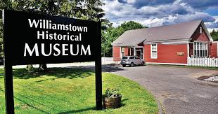
65. 32 New Ashford Road. South Center School. 1865. Built by Edward Curtis as the South Center School, replacing the original 1810 building across the road. As enrollment declined in the mid-20th century, the school, by then known colloquially as the “Little Red Schoolhouse,” closed in 1962. From 1927 to 1962 it also housed the South Williamstown Public Library.” It was home to the Williamstown Cooperative Nursery School from 1964 to 2012, and since 2017 home to the Williamstown Historical Museum.
Tag: Schools
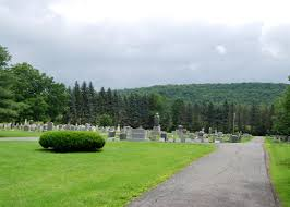
66. 30 New Ashford Road. Southlawn Cemetery. 1769. Behind the Williamstown Historical Museum, the cemetery was laid out on land given by South Williamstown’s first settler, Isaac Stratton. The first burial was in 1777: Reuben Burbank, three-year-old son of the second family to settle in the neighborhood. Among those buried here is Belle Smith (1864-1949), who taught for many years at the South Central School. Others include Strattons and Youngs and other early settlers and Revolutionary War veterans.
More:
Benjamin F. Mills (who founded the Mills Institute), members of multi-generational farming families, and fifteen members of the Steele family (who ran Steele’s Store) are also buried here.
Tag: Cemeteries
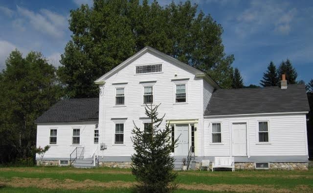
67. 374 New Ashford Road. Hart Farmhouse. 1802. The middle section (24’x28’) of this house was built about 1802 and the wings were added later. The house was part of a 156-acre farm on both sides of New Ashford Road. It used to sit close to the road, and was moved back in 1950 by the African-American Henry Hart Family, which ran a construction and carting company in Williamstown and bought it along with land across the road. Operated by the Harts as a summer camp for Black and white children from New York City from 1947 to 1963, it now serves as a BnB they call “The Farmhouse.”
The Harts ran a service station across the road from 1954 to 1971. They continue to use that building as a garage for their trucking and carting business.
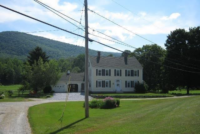
68. 720 New Ashford Rd. Deming Farm. Circa 1802. The house, part of the old 330-acre Titus Deming farm, was built at the intersection of the New Ashford Road and what was then called East Street (now the discontinued section of Potter Road), which led to the Hopper. It is notable for its two handsome doors, one on the south side and one on the west side. The garage on the north side was added later. The farm was later owned by the Roys Family and the Dickinson Family, who called it White Star Farm. Now less than four acres, it is still known as White Star Farm.
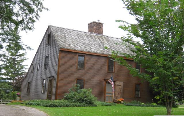
69. 83 Sloan Road. Clark-Young House. 1765. A saltbox built by Capt. Samuel Clark, who later fought at the Battle of Bennington in 1777. Still later (1790) it was the home of William Young who served in the Massachusetts General Court between 1792 and 1808. Five fireplaces open off a central chimney. On the second floor a room with a barrel-vaulted ceiling was the meeting place for a South Williamstown Masonic Lodge.A now-detached 1861 barn has original unmilled joists. The house has been fully restored, and preserves many of its colonial features. It is now a private residence.
Tag: Colonial Williamstown
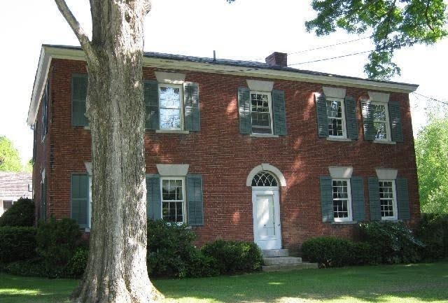
70. 61 Hancock Rd. Porter House. 1813. Built by Dr. Alanson Porter; the first doctor in South Williamstown, of red brick fired in a nearby pasture across the road (now Waubeeka Golf Links). The house is built with eighteen-inch thick walls to withstand fire, and long rods through the house to hold it together. It is still a private residence.
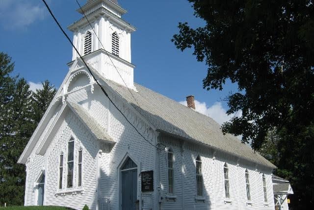
71. 75 Hancock Road. Second Congregational Church. 1875. In the early years Congregationalists in South Williamstown had to travel four miles north to worship at the Meetinghouse at The Square. In 1808 they put up a building which they shared with a small group of Baptists; preachers came down from the north village and over from Berlin, NY. In 1834 the Baptists withdrew and built their own church on Green River Road, and in 1836 the Congregationalists formally established the Second Church. In 1875 they built the present structure, and in 1885 the parsonage next door. In 2012 the church celebrated its 175th anniversary.
Town meetings were held in an upstairs room every other year from 1844 to 1859.
Tag: Churches
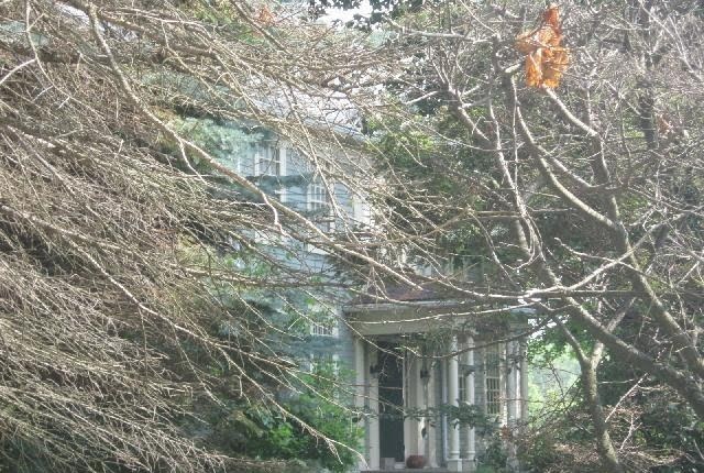
72. 153 Hancock Road. Foster House. 1800-1810.The southern wing may have been built as early as 1800.The main house was probably built about 1808 by Ebenezer Foster, an early settler who served as a selectman and a state legislator. Its style is Georgian, with a fan window over the door and stenciled interior walls. In the early 20th century the house was used as the “Mount Pleasant” summer camp for a few boys from a military academy in Ossining, NY. It is now a private residence.
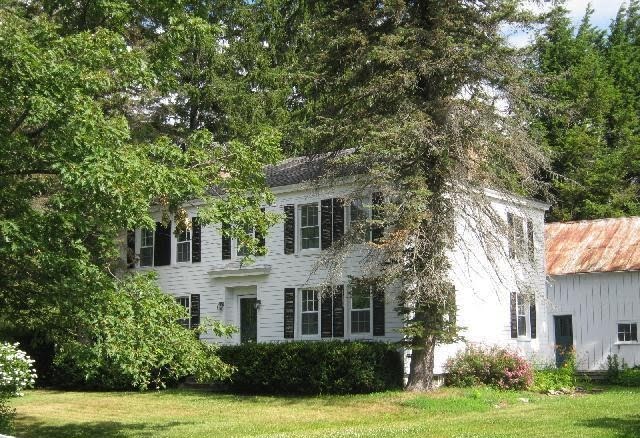
73. 523 Hancock Road. 1780s. The rear part of the house may be older. The 36’x26’ front part of the house has wide pine floorboards, three fireplaces, and chestnut posts in the basement. The house is a private residence.
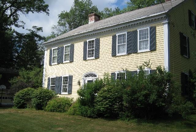
74. 905 Hancock Rd. Young House. Circa 1770. Built by Moses Young, with decorative details (elliptical door windows, fluted corner pilasters, and medallion cornice) from about 1810. Some original wide floorboards survive. Additions to the rear of the house were made over the years. It was owned by Young and his descendants until 1941. It remains a private residence.
Tag: Colonial Williamstown
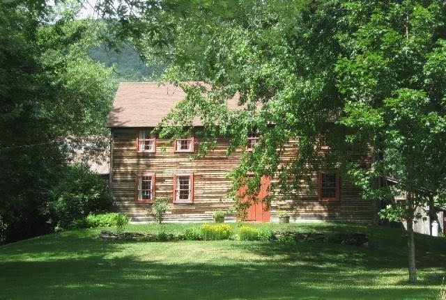
75. 1501 Hancock Road. Comstock House. 1773. The 18’x38’ front part of this saltbox, the fourth house from the Hancock town line, is the oldest part. It was built by Ishmael Comstock (1750-1820), and owned by his descendants for several generations. Over time two rooms and a garage were added on to the back of the house. The unpainted narrow clapboards are unusual. In the late 20th century it was owned by antique dealers who restored the house; discovered a large central chimney, with a marble mantel, a bake oven, crane, and kettle; and exposed the cherry beams in the 7’ ceiling. It is a private residence.
The house apparently served as the residence for a large farm which was subdivided several times in the 20th century.
Comstock’s brother, Thomas, bought land nearby in the 1790s, and his family farmed it until 1932. Ishmael Comstock’s tombstone, which formerly stood in a family graveyard, at one time formed part of a patio wall behind the house.
Tags: Colonial Williamstown